Web App (Currently a WIP)
Ar-Terra
A precision 3D site modeling platform for architects and designers.
Problem
Architects lack a fast, accessible way to generate precise 3D terrain models early in the design process. Existing tools either offer high precision but require GIS expertise and cumbersome workflows—or are simple to use but lack the detail and control needed for architectural work.
Solution
Ar-Terra bridges this gap with a lightweight, architect-friendly web tool that delivers high-resolution 3D terrain from custom site boundaries—no GIS expertise required. Users can quickly preview, generate, and export terrain meshes with real-world accuracy to support early design decisions.
As a bonus, optional AI-powered features enhance the experience with:
• Intelligent tree detection (species and height)
• 3D building context
• AI-enhanced satellite imagery and textures
• Seasonal solar analysis
This enables architects to work faster and smarter—with geospatial context that feels intuitive and design-ready.
Details
06/2025 -> Present
Team
Individual Project
Contribution
Founder, Product Designer,
& Full-Stack Developer
Platform
Web App

User Research
I spoke with architects and landscape designers to understand how they currently model terrain for early-stage design. Most relied on manual workflows, rough topography, or outdated data. The biggest friction point? Precision. They wanted fast, accurate site context—without getting a headache. These insights helped define Ar-Terra’s core value: seamless, high-fidelity terrain modeling, built for creative iteration.

Market Research
To better understand existing solutions for 3D site modeling, I evaluated several tools commonly used in architecture and landscape workflows. The top 2: SketchUp’s Geo-location tool and ArcGIS. Each offers varying levels of accuracy, usability, and integration with design tools. While they provide access to terrain data, I identified gaps in speed, design flexibility, and accessibility for early-phase prototyping.

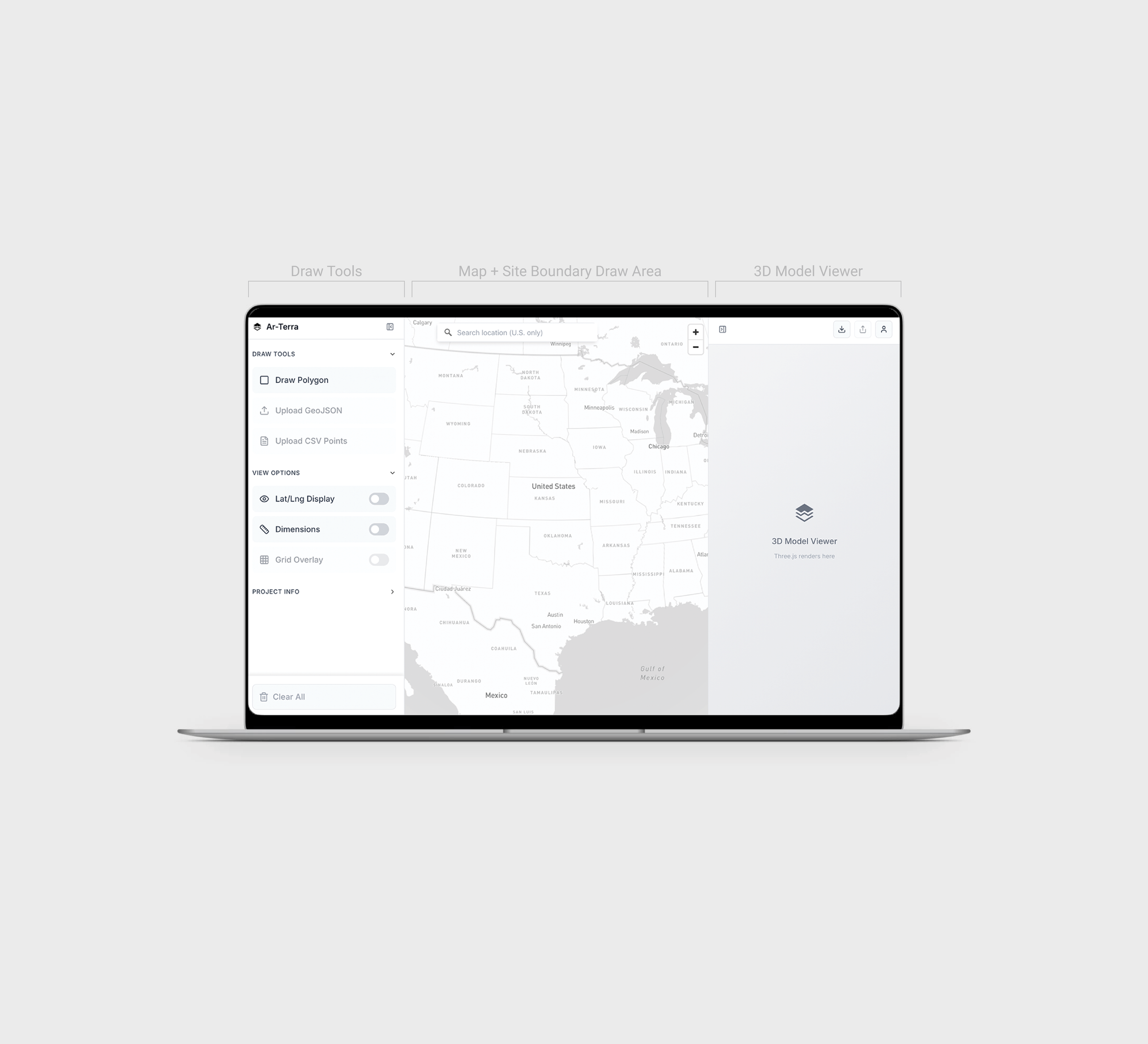
Early Interface Iterations
(WIP)
To establish the core interaction model, I began with early visual mockups of the Model Builder page—Ar-Terra’s central workspace. These high-fidelity screens explored different panel states and helped define how users would search locations, draw geometry, and view contextual data like dimensions and coordinates. These explorations laid the foundation for a focused, utility-first UI that supports rapid site analysis.
You can view the current frontend prototype here.
Design System
The visual language of Ar-Terra was designed to reflect clarity, technical precision, and usability. The interface uses a restrained, neutral palette of soft grays and crisp whites to create a sense of space and focus. The design system prioritizes hierarchy and minimalism, ensuring that the data and tools take center stage without unnecessary visual noise.

& More
Coming Soon! Ar-Terra is an active WIP.